
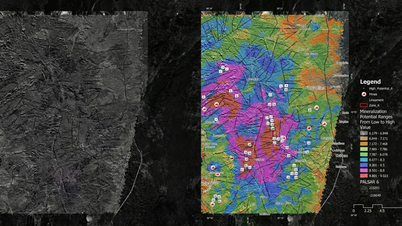
Mineral prospectivity mapping is a ranking problem conducted with incomplete, spatially biased evidence. Validation must therefore answer more than “how accurate is the model?” It must show what was tested, how spatial dependence was handled, where the model is uncertain, and whether the result is useful for the next exploration decision.
Why one accuracy number is not enough
Known occurrences are rarely a random sample of the landscape. They reflect access, historical exploration focus, mapping intensity, reporting practices, and the geological ideas that guided earlier work. Non-occurrence labels are even more difficult: an untested location is not necessarily barren.
A high headline score can result from:
- Spatial leakage between nearby training and test samples.
- Severe class imbalance.
- Reusing known occurrences in predictor layers.
- Testing inside the same geological domain used for training.
- Selecting thresholds after viewing test performance.
- Measuring interpolation near known deposits rather than prediction into new ground.
This is why the validation design must be visible alongside the result.
Separate model validation from exploration validation
These are related but different questions.
Model validation
Model validation tests whether the method generalizes under a defined sampling design. Depending on the task, it may examine:
- Spatially blocked cross-validation.
- Holdout areas or geological domains.
- Precision, recall, ranking, calibration, or area-based capture.
- Sensitivity to negative or unlabeled sampling.
- Stability across feature sets and model choices.
Exploration validation
Exploration validation asks whether the ranking improves a real decision. It may include:
- Independent geological review.
- Comparison with occurrences not used in modeling.
- Field mapping and observation.
- Targeted geochemistry or geophysics.
- Drilling or trenching where justified.
- Post-field updates to the evidence model.
A model can be statistically consistent but geologically unhelpful. It can also generate a useful screening hypothesis without supporting a claim of discovery.
Treat uncertainty as an output
Uncertainty should not be hidden inside a single probability or prospectivity score. Useful uncertainty reporting can include:
- Data gaps and acquisition limitations.
- Model disagreement.
- Sensitivity to feature weights.
- Prediction stability across resamples.
- Distance from training examples.
- Confidence bands or ranked tiers.
- Alternative geological explanations.
The question is practical: what would cause this target to move up or down after the next observation?
Explainability needs geological interpretation
Feature importance, SHAP values, or evidence-weight summaries can show which inputs influenced a score. They do not prove that the relationship is causal or geologically valid.
An explainability view is most useful when it lets a geologist ask:
- Does the target respond to evidence expected for the deposit model?
- Is one proxy dominating for an implausible reason?
- Could topography, vegetation, infrastructure, or data density explain the result?
- Are correlated layers giving the same observation too much weight?
- Does the model behave consistently across geological domains?
Explainability is therefore a review interface, not a scientific conclusion.
Minimum validation record for a target package
A decision-ready prospectivity package should document:
- Target definition — what the model ranks and at what spatial unit.
- Label provenance — source, date, quality, and use of known occurrences.
- Feature provenance — sensor, acquisition, processing, resolution, and geological rationale.
- Sampling design — how training, validation, and test areas were separated.
- Metrics — why each metric suits the decision and class balance.
- Sensitivity — how rankings change under reasonable alternatives.
- Limitations — known blind spots and possible false positives.
- Field checks — observations capable of strengthening or rejecting the target.
Communicating results to decision-makers
Technical transparency should survive the executive summary. A concise target register can include:
| Field | Purpose |
|---|---|
| Priority tier | Supports sequencing without false precision |
| Principal drivers | Shows why the target ranked |
| Confidence context | Describes evidence completeness and stability |
| Competing explanation | Makes false-positive risk visible |
| Recommended check | Converts analysis into action |
| Stop condition | Defines evidence that would downgrade the target |
This format is more defensible than presenting an unexplained score from 0 to 100.
The responsible claim
Prospectivity mapping can organize evidence, identify patterns, rank areas, and guide additional work. Its validation should be proportional to that role. Unless field and drilling evidence supports a stronger conclusion, results remain screening-level priorities.
The credibility of a prospectivity model is not established by how confidently it is presented. It is established by whether another technical team can inspect the inputs, reproduce the logic, challenge the assumptions, and test the ranked targets.